Aqua Map Boating v32.2 [Unlocked]
Requirements: 8.0+
Overview: An app to satisfy all your Fishing and Boating’s needs, developed with the help of professional fishermen. You will download the best nautical charts and enjoy your new fishing season.

An app to satisfy all your Fishing and Boating’s needs, developed with the help of professional fishermen. You will download the best nautical charts and enjoy your new fishing season. Press the RECORD button, put the phone in your pocket and record your fishing trolling track….and much more.
►► Features:
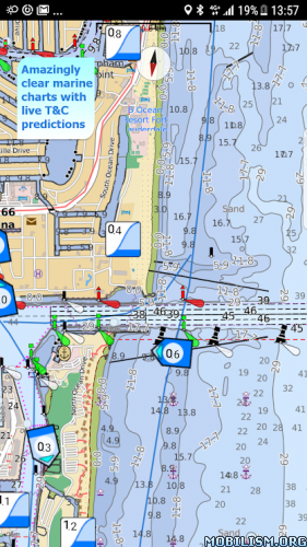
• Amazingly clear marine maps
• Only Official nautical charts (see list below) from National Hydrographic Offices
• You can download the maps on the device, to be used later without any internet connection
• Tides & Currents Prediction plus the ability to simulate their trend on the screen (now only in US)
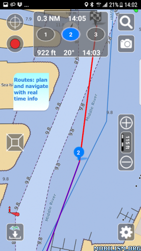
• Plan and navigate your ROUTE with real-time information on next waypoint
• Expand your horizons with mapXpan (patent pending)
• Easy to use
• ActiveCaptain community integration
• Optimized battery usage with battery consumption monitoring
• Share and load tracks, markers, routes and pictures in various formats (KMZ and GPX)
• Add the Satellite images as overlay of your maps
• Measure distances on the map.
• Query map objects with your finger tip
► MAPS
Aqua Map lets you download the best Nautical charts with depth contours, buoys, lights, etc. and all it is necessary to enjoy your best marine experience. You can download the maps at home within your device and then use them on the boat without any Internet connection.
We use only official Hydrographic offices: NOAA, CHS, BA, BSH, etc.
Available areas: US, Canada, Caribbean, Brazil, Argentina, UK, Ireland, Spain, Portugal, Italy, Germany, Netherlands, Belgium, Croatia, Estonia, Malta, Seychelles, Maldives, Emirates, South Africa, New Zealand.
► TIDES & CURRENTS
You can calculate the prediction for more than 5800 stations in the US. You can also have a simulation of the T&C trend on the map by minute wise precision.
► mapXpan
This map mode will greatly extend your display; you will have the details you need for a safe navigation seamlessly integrated with a large overview area. Using this mode you will see a map 64 times larger without losing any detail in the center part of the screen.
► ROUTES and WAYPOINTS
Plan your trip, insert and edit waypoints. Navigate your route and monitor distance, time (ETA) and direction toward your next waypoint or your final destination
► LOADING and SHARING
With Aqua Map you can share your favorite’s markers or send an email with your last daily track. Not only, you can also load any KML, KMZ, GPX you can find over the internet or receive from your friends.
► ENJOY ActiveCaptain Community
Join the community of more than 100.000 boaters who write reviews, update data and provide up to date hazard information.
Follow us on Telegram and contribute reviews and rating about marinas, shared local boating knowledge, anchorage and hazards
Terms of Service: http://www.globalaquamaps.com/Acknowledge.html
– All Charts & Features Unlocked
– Not all regions/areas have maps available so don’t report if no maps are available for you.
What’s New:
• Improvements and bug fixing
This app has no advertisements
More Info:
https://play.google.com/store/apps/details?id=com.gec.MarineApp.WorldViewerLiteDownload Instructions:
https://devuploads.com/8qz9cid762h6
Mirror:
https://uploadrar.com/1e3uww4yskv0
You like the post? Follow us on Telegram .

